Home Newsletter Locations Diary
 Indexes
Topic Alpha County Sections By

Travellers Resource
Lighthouse Section Lighthouse Index . England & Wales Scotland Ireland Isle of Man Channel Isles

 Maps

England & Wales Scotland Ireland

Anvil Point Lighthouse

Swanage, Dorset

Featured Location Guide

Photo by Andy Jamieson 

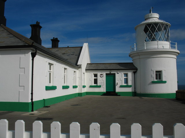
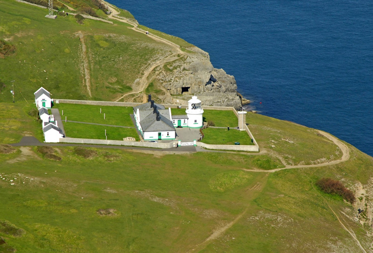
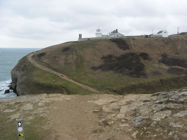
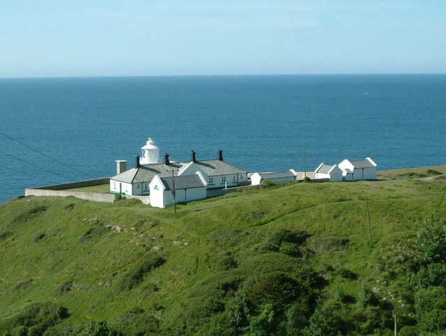
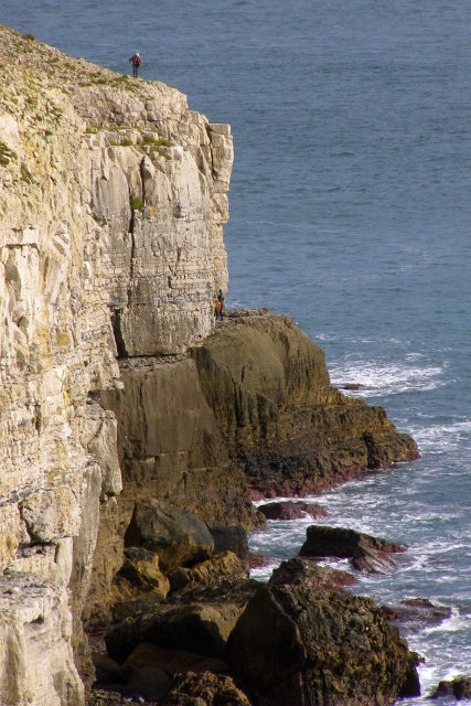
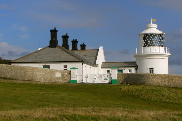
Anvil Point Lighthouse,  was completed in 1881, it is built of local stone. It is a white tower located on a cliff top, with buildings next to it.

It was opened by Neville Chamberlain's father, then Minister of Transport.

The light is positioned to give a waypoint for vessels on passage along the English Channel coast. To the west it gives a clear line from Portland Bill and to the east guides vessels away from the Christchurch Ledge and leads them into the Solent.

The light was originally illuminated by a paraffin vapour burner. In 1960 the station was modernised and converted from oil to mains electricity. The old fog signal, a 5 minute canon, was replaced in 1981 by new automatic equipment. The fog signal has now been discontinued. Anvil Point Lighthouse was automated on 31st May 1991 and is monitored and controlled from the Trinity House Centre at Harwich.

It now uses a 250mm lens, the original Fresnel lens is on display at The Science Museum in South Kensington, London.

The pubic can visit, see opening times and other information below.

.

Photo Marinas.com (others images available)

See Larger Image

Photo by Maurice Budden

See Larger Image

Photo by Barry Deakin

See Larger Image

Photo by Andy Gilbert

Photo by Jim Champion

Photo Jim Champion

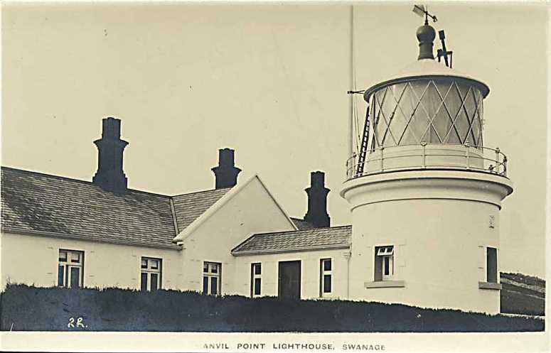
Old postcard view - date not known


Lighthouse information Grid

Name:

Anvil Point Lighthouse

Current status:

Lighthouse is in use, Open to visitors - see below

Geographic Position:

50° 35'.48 N 01° 57'.51 W

Grid Reference:

SZ029768

Ceremonial County:

Dorset

Appearance:

Cliff top White Tower by buildings.

Round cylindrical stone tower with lantern and gallery, painted white with green trim, attached to 1 storey keeper's quarters

Map Link:

Streetmap   Multimap Get-a-map

Aerial photo:

Marinas.com    Multimap   Google satellite view

Other photos:

Geograph

Originally built:

1881

Current lighthouse built:

1881

Height of Tower:

12m 39ft

Height of light above mean sea level:

45m 149ft

Character of light:

White Flash Every 10 Seconds

Character of fog signal:

None

Range of light:

24 Miles

Owned / run by:

Trinity House

Website:

TH    TH open

Other Useful Websites:

LD

Routes:  

Notes:

Cottages available for holiday rental


.


Lighthouse Visit Planning Grid

Name: Anvil Point Lighthouse
Grid Reference: SZ029768

Location:

Anvil Point Lighthouse is situated within the grounds of Durlston Country Park and approximately 2 miles up the hill from Swanage town centre.

Getting there: At the end of Lighthouse Road about 3km (2 mi) south of Swanage
Access:  

Parking:

There is a large public car park at Durlston Country Park at the start of the approach road.

Address:


Postcode:


Telephone:

07818 268191 or 01255 245011

Email: anvilpoint.keeper@talktalk.net

Opening times:

See Trinity House Open times   of when this is open and

Trinity house Lighthouse closure page

A PDF can be downloaded relevant to the 2010 year.

Charges:

Adults £2.50, Children (up to 16) £1, Family (2+3) £7

Best Times to Visit: Check opening, access and tide times.

Facilities:


Things To Do, See and Photograph:

Lighthouse, coastal, wildlife, plants, possibly ships.

What to take:

Shoes suitable for climbing many steps, small bag with necessary items, Camera, selected lenses and filters.

Nature highlights:

Coastal birds

Photo Restrictions:

None Known

Other Restrictions: None Known
Nearby Locations:  
Other Relevant pages:

For more articles, lists and other information see the Lighthouses Section

Lighthouse Map of England and Wales

Featured List of Lighthouses - England and Wales  

List of Minor Lighthouses and Lights - England and Wales

Please let us know any other information that we can add to the Further information and Planning Grids or page and any errors that you discover. Before making a long trip to any location it is always wise to double check the current information, websites like magazines may be correct at the time the information is written, but things change and it is of course impossible to double check all entries on a regular basis. If you have any good photographs that you feel would improve the illustration of this page then please let us have copies. In referring to this page it is helpful if you quote both the Page Ref and Topic or Section references from the Grid below. To print the planning grid select it then right click and print the selected area.

Please submit information on locations you discover so that this system continues to grow.


By:  Keith Park   Section: Lighthouses Key:
Page Ref: Anvil_Point Topic: Lighthouses Last Updated: 06/2010

.

This page:

Link directly to this page, with text or the button on right.

Text linking:  Anvil Point Lighthouse on Photographers Resource

Linking Instructions                            http://www.photographers-resource.co.uk/

Photographers Resource, all the information for the photographer