| Home | Newsletter | Locations | Diary |
| Indexes |
|
| Travellers Resource |
|
|
|
|
|
Maps |
|
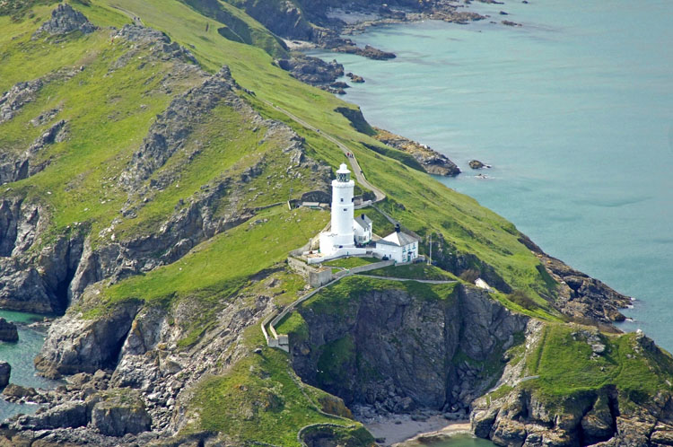
Aerial photo By
Marinas.com
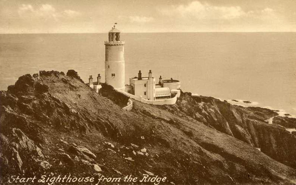
Since this old postcard photo
was taken erosion has caused some parts to fall away, including the
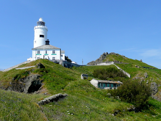
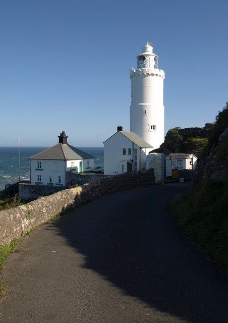
Start Point is one of the most exposed peninsulas on the English Coast, running sharply almost a mile into the sea on the South side of Start Bay near Dartmouth. The Lighthouse, sited at the very end of the headland, has guided vessels in passage along the English Channel for over 150 years. James Walker designed Start Point Lighthouse in 1836 and it owes much to the
"gothic" movement in architecture of the time, with its battlemented parapet.
Two white lights were originally exhibited, one revolving and one fixed to mark
the Skerries Bank. A fixed red subsidiary light still marks this hazard. The
optic used was the first of its kind in the Trinity House Service, being an
approved form of Dioptric apparatus designed by Alan Stevenson, whose major work
was the optic at the
Skerryvore
Lighthouse
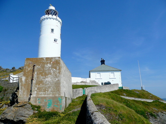
The machinery was housed in a small building on the cliff face and operated by a weight which fell in a tube running down the sheer cliff. A siren replaced the bell after only fifteen years because the new steam ships could not hear the bell. In 1871, the intermediate floors of the tower of 1836 were removed and new keepers' houses were built nearby, common with all Trinity House Stations. An insight into the Lighthouse and the life of its keepers in the nineteenth century is given in a travelogue by Walter White:-
The light was powered by oil until 1959 when it was electrified In recent years the ground under the fog signal house has become insecure finally resulting in the collapse of the building in December 1989. Since then the site has been levelled, a new retaining wall built and a free standing fog signal stack put in place. However some think that the station is somewhat endangered by erosion of the cliff on which it stands. Work began on the automation of Start Point Lighthouse in August 1992, this was carried out by LEC Marine at a cost of £82,754 and was completed in early 1993. The station is now monitored and controlled from the Trinity House Centre at Harwich in Essex.
The building lower down to the right is a block of old pig sties dating back to when the lighthouse keepers tended their own smallholding on the steep northern side of the headland.
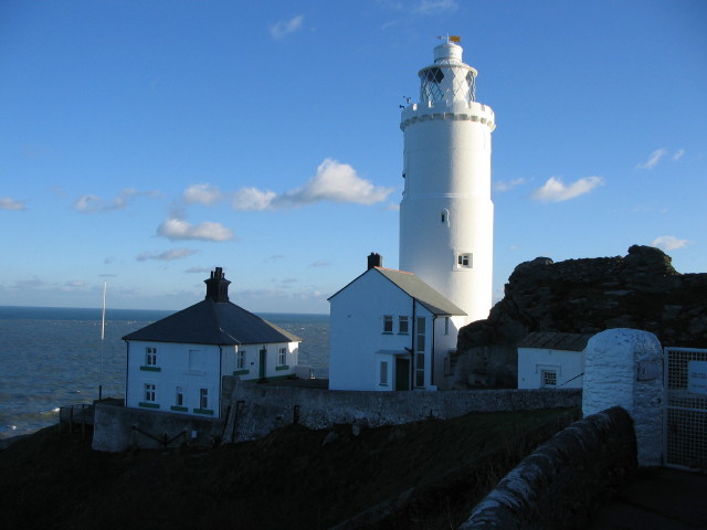
Getting the near impossible shot from the cliff edge
An architectural description Tarred and white-painted granite ashlar with cast iron lantern roofed in copper. Tall circular tower of about 28 metres high with moulded plinth and pedestal stage and 2 diminishing stages above that, the top stage with a corbelled embattled parapet and a cast iron lattice lantern with a copper canopy surrounded by weathervane. Rectangular and small round-headed window openings with plain raised architraves and blind panel on west side under the parapet . Visiting The lighthouse is open for visits, see the grids below for information on cost, links to find out when its open and other information. Each tour is approximately 45 minutes.
.
Please let us know any other information that we can add to the Further information and Planning Grids or page and any errors that you discover. Before making a long trip to any location it is always wise to double check the current information, websites like magazines may be correct at the time the information is written, but things change and it is of course impossible to double check all entries on a regular basis. If you have any good photographs that you feel would improve the illustration of this page then please let us have copies. In referring to this page it is helpful if you quote both the Page Ref and Topic or Section references from the Grid below. To print the planning grid select it then right click and print the selected area. Please submit information on locations you discover so that this system continues to grow.
|
|||||||||||||||||||||||||||||||||||||||||||||||||||||||||||||||||||||||||||||||||||||||||||
. |
|||||||||||||||||||||||||||||||||||||||||||||||||||||||||||||||||||||||||||||||||||||||||||
|
|||||||||||||||||||||||||||||||||||||||||||||||||||||||||||||||||||||||||||||||||||||||||||
|
|