| Home | Newsletter | Locations | Diary |
| Indexes |
|
| Travellers Resource |
|
|
|
|
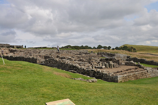
Said to be the best preserved Roman fort in Britain. One of the 12 forts added to the Wall in about 124AD. It was designed as an auxiliary fort to contain a garrison (2 cohorts) of 800-1000 men and later also some cavalry. There are large sections of wall in each direction, with good views. However note that the fort is a long uphill walk from the car park.
Its said that initially it
has an unknown double sized auxiliary cohort, and a detachment of
legionaries (professional roman soldiers who signed up for 25 years),
from legio II Augusta.
Its roman name Vercovicium means 'the place of effective fighters'.
The fort was built in stone in 124AD, two
years after
Hadrian's Wall,
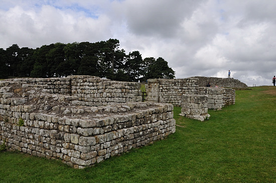
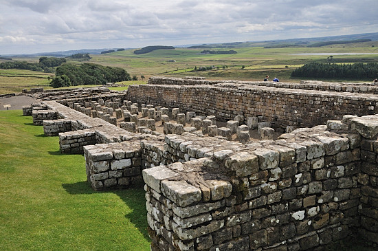
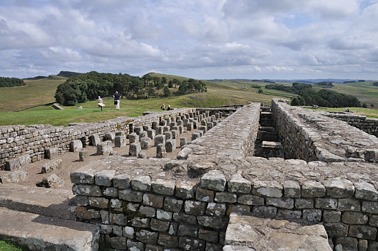
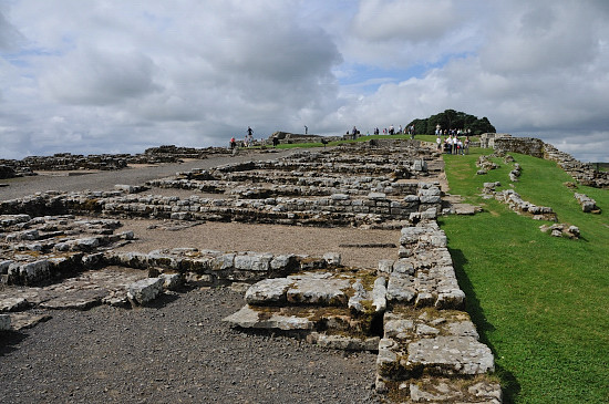
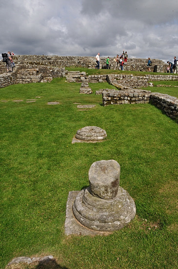
The overall layout of this fort changed little, although rebuilding occurred several times and particularly the northern defensive wall was prone to collapse and modifications to buildings occurring. What is on display represents examples from different time periods. The curtain wall, with turrets and 4 twin towered gateways can be seen, together with a headquarters building, a commanders house, granary, barrack block, hospital, latrines and more. More humps and bumps show unexposed areas. A civilian settlement was on the south and west of the fort.
The west gateway
Granaries
Part of a barrack block
The commanding officers house This position has no natural water supply, and several large stone lined tanks can be found within the fort. It is assumed these were used to store rainwater, but its also possible that there were springs further down the hill that supported the civilian population and bathhouse, as well as a supply that could be taken up to the fort. At the site you see south of the fort a round wall and a deep well, this is later than the roman period, but perhaps there is a roman well still to be discovered.
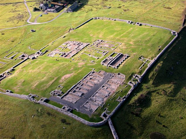
Aerial photo by Simon Ledingham
used with permission. Previously on
www.visitcumbria.com
The image above shows the layout well. You can see the wall around and the four gateways. We are looking towards the south east, the wall comes from the bottom right and goes away to the west in the top right. The most prominent building in the bottom right is the barrack block, to the left of this, more like an outline, is a store room, with a bath house more distinct near to the gateway. Above the barrack block is granaries, and less distinct to its left is the Headquarters building. The larger building to the left again is the commanding officers house. Above the headquarters building is the hospital. At the extreme left just within the wall you can see the latrines, and outside the wall some parts of the civilian settlement. Above the north gate (right of image) and to the right of the granaries you can see the remains of turret 36b and the wall that was her before the fort. You can also see where the towers were on the perimeter wall.
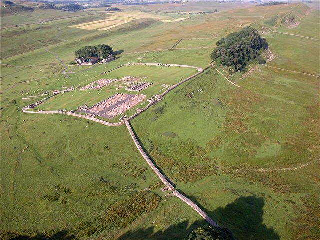
Aerial photo by Simon Ledingham
used with permission. Previously on
www.visitcumbria.com
This second aerial photograph shows the fort in relation to the
wall and landscape. The wall comes from the bottom right and goes off along the
ridge to the top right. The walk to
Milecastle 37
See also the gallery
.
Please let us know any other information that we can add to the Further information and Planning Grids or page and any errors that you discover. Before making a long trip to any location it is always wise to double check the current information, websites like magazines may be correct at the time the information is written, but things change and it is of course impossible to double check all entries on a regular basis. If you have any good photographs that you feel would improve the illustration of this page then please let us have copies. In referring to this page it is helpful if you quote both the Page Ref and Topic or Section references from the Grid below. To print the planning grid select it then right click and print the selected area. Please submit information on locations you discover so that this system continues to grow.
|
||||||||||||||||||||||||||||||||||||||||||||||||||||||||||||||||||||||||
. |
||||||||||||||||||||||||||||||||||||||||||||||||||||||||||||||||||||||||
|
||||||||||||||||||||||||||||||||||||||||||||||||||||||||||||||||||||||||
|
|