| Home | Newsletter | Locations | Diary |
| Indexes |
|
| Travellers Resource |
|
|
|
|
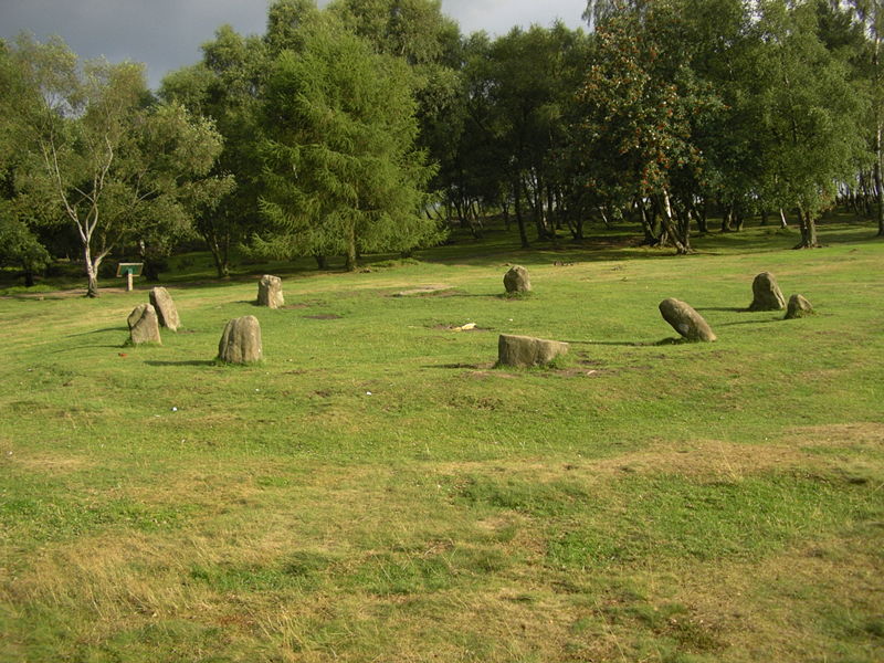
Nine LadiesDerbyshire
From 1999 to 2004 this site was in the news over proposed quarrying nearby, eco warriors in the trees and a later court action where the quarries concerned were classified as dormant and cannot re-open. The area is now protected from development. This means that the quarries cannot re-open until the Peak District National Park Authority agrees on a set of working conditions for them. Stone circles often come on 3's in this case on the map (multimap) you can see 3 in a line running diagonally. Second is Doll Tor (SK238628) stone circle nearby. Difficult to see from the air as its on the edge of woodland. Third known as the Grey Ladies or Nine stones Close (SK225626) from the air on a Google aerial photograph. Only four stones remain of what once was a 45foot circle of stones. The stones are the tallest in Derbyshire, ranging from 1.2m (4 feet) to 2.1m (7 feet) in height, the tallest being located at the southern end of the circle. Link to external site for more information. See also The discussion on the purpose of stone circles Planning Grid
Please let us know any other information that we can add to this Planning Grid or page and any errors that you discover. Before making a long trip to any location it is always wise to double check the current information, websites like magazines may be correct at the time the information is written, but things change and it is of course impossible to double check all entries on a regular basis. If you have any good photographs that you feel would improve the illustration of this page then please let us have copies. In referring to this page it is helpful if you quote the CIN Page Ref at the bottom of the Planning Grid above. To print the planning grid select it then right click and print the selected area. Please submit information on locations you discover so that this system continues to grow. |
||||||||||||||||||||||||||||||||||||||||||||||||||||||||||||||||||||||||||||||||
|
||||||||||||||||||||||||||||||||||||||||||||||||||||||||||||||||||||||||||||||||
|
|
||||||||||||||||||||||||||||||||||||||||||||||||||||||||||||||||||||||||||||||||