| Home | Newsletter | Locations | Diary |
|
Indexes |
|
|
|
Article IslandsThe British Isles, as the name suggests, is a collection of islands, one very large one, one smaller, several medium sized and then a load of others. Of these the majority are not occupied, some of the unoccupied are used in the summer months for farming, some are wildlife reserves.
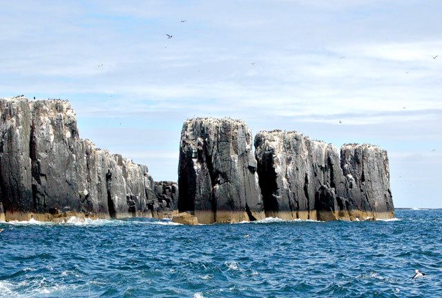
Staple Island Sea
Stacks
Most are accessible, if you have access to a boat or helicopter, and all the occupied plus many of the nature reserves are accessible by ferry. 136 islands are permanently inhabited, with a permanent population of around three quarters of a million people, but many visitors as well. This larger number of islands of the mainland island, accounts for around 4.4 % of the total land mass. So about one in every twenty three square miles of the UK is on an island off the mainland of either England or Northern Ireland. A very large percentage of the total are in Scotland, where there are a number of large groups of islands. The Shetlands includes at least 300 islands, 35 major islands of which 16 are inhabited, the Orkneys has 70 islands, 20 inhabited, Outer Hebrides over 100 islands plus many smaller islets with 15 inhabited, Inner Hebrides has 79 islands plus many islets, of which 36 inhabited, and the Islands of the Clyde has 40 islands plus smaller islets, 6 inhabited. In Scotland 97 islands are populated, of which 92 are offshore islands. 14 islands are populated by over 1,000 people and 45 by over 100, the total population of all the islands in 2001 was 99,739. 5 freshwater islands are populated, 3 of these in loch Lomond. In total Scotland has 200 islands larger than 40 hectares (100 acres), 12 of these being in fresh water. The largest island is Lewis and Harris in the Outer Hebrides, which extends to 2,179 square kilometres, and is a single island with a mountain range dividing it.
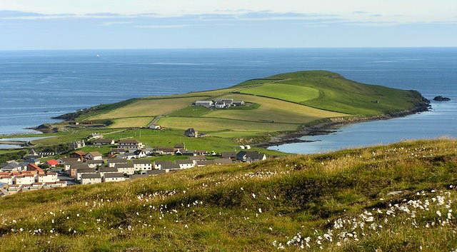
Ness of Sound, Shetland
Looking around the UK coast line you can find many islands, some like the Isle of Wight and Anglesey are the size of a county, others varying in size to be far smaller. Some are some way off shore some others have a causeway allowing access for a part of each tide cycle. Turn our attention to lakes and rivers and we can find many more islands, there are many in the Lake District and a very large number in the Scottish lochs. Loch Lomond has over 30 islands including the largest freshwater island in the UK. Surprisingly this is not a major tourist attraction on the UK, yes some islands are visited, but few here or visiting from overseas are even aware that so many islands exist, and little serious interest has been put into marketing this natural resource. There are many islands that at points in history had a population of over 100, that are now unoccupied, and have now just become out of sight and out of mind. With modern technology like satellite phones, wind generators and fast boats, eventually I expect the politicians or perhaps business people will realise just the size of these missed opportunities. If you visited an island every week then it would take you two and a half years to visit those that have someone living on them and to visit the rest may be longer than your lifetime. Its just that little bit more difficult to visit an island, unless its bridged, but perhaps we should all consider some that we would just love to visit.
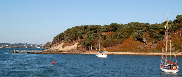
Pottery Pier, Brownsea Island
To get you started we have produced a series of tables showing significant, but not all islands, divided into country pages. Significant Islands of the UK for:-
We also have some islands written up either as
articles or as location guides, you can find these from links in the lists, or
our
Islands
Section.
How many islands are in the British Isles? There is no answer to this question, in part because there is no definition of what is an island. We could include coastal islands or all islands including those in lakes and rivers, we could include just inhabited islands, just ones above a set size. Is it an islands when it is never connected to land, or is it an island if the tide comes in and cuts it off from the mainland, so is it an island when there is causeway at low tide, or what about a place that becomes an island on higher than normal tides or when there are floods. What about islands within inland lakes, the Lake District has at least 40 of these. The largest problem in getting a number is in defining the size, as there are many lumps of rock around our coast that all or part of the time are above the water and by some definitions are islands. What about Crannogs, man made islands. If we include everything then one estimates including every bit of rock is around 10,000.
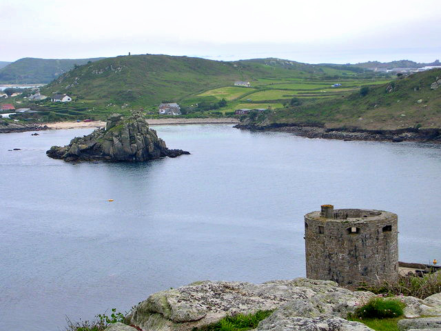
Cromwell Castle, Tresco
overlooking Bryher Island, Isles of Scilly
On the other hand the United Nations lists
just 26, but some of these are groups of islands, for example the Scilly
Isles or Scottish groups.
UN list of islands
So what do those who should know say.
r.
In the last census, 136 islands were
permanently inhabited. Land on islands, except the mainland of England,
Scotland, Wales and Northern Ireland accounts for 13,950 square kilometres
which is 4.4 % of the total land mass. We think that in total there
are around three quarters of a million people in Britain living on islands
away from the mainland. Examples are:- Isle of Wight accounts for 133,000, and Anglesey 69,000 on the main island and 13,500 on
Holly Island off Anglesey.
List of island and populations
We can find listings of islands in Wikipedia for each country:-
View of Scapa Flow from
Stromness, Orkney
We have produced our own list, of
Significant Islands in the British Isles,
Significant Islands of the UK So lets ask another question Where does Britain (main island) sit in the list of largest islands in the world The United Nations say 8th, Wikipedia 9th, but neither of these include continents. Australia is counted not as an island but a continent so excluded, as is Antarctica. Antarctica is mostly ice, and if all the ice was removed some of the points it rests on would be below water level, however its said that with the weight of the ice removed the land would rise, but no one knows by how much so its not possible to say how big in theory Antarctica is, there is also the possibility it would be a continent like Australia not an island. See also:
Significant Islands of the UK:- |
||||||
|
||||||
| . | ||||||
|
||||||
|
|