| Home | Newsletter | Locations | Diary |
| Indexes |
|
| Travellers Resource |
|
|
|
|
|
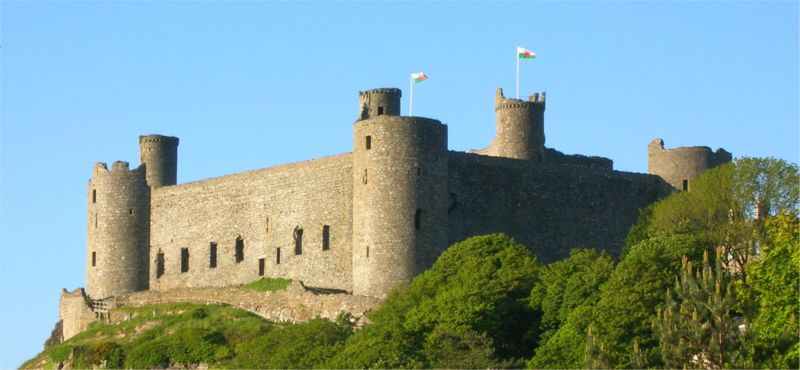
"A part of the World Heritage Site Castles and Town Walls of King Edward in Gwynedd"
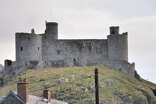
Harlech Castle was retaken after an 8 month siege in 1409 by Prince Henry (later Henry V) and a force of 1000 men under John Talbot, during which Edmund Mortimer starved to death and Glyndŵr's wife, Margaret Hanmer, two of his daughters and four grandchildren (children of Mortimer) were captured, later to be imprisoned and die. The song 'Men of Harlech' came about during a seven year siege, during the Wars of the Roses, it was developed to keep up the moral of those inside.
Harlech Castle
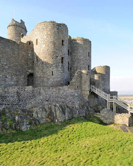
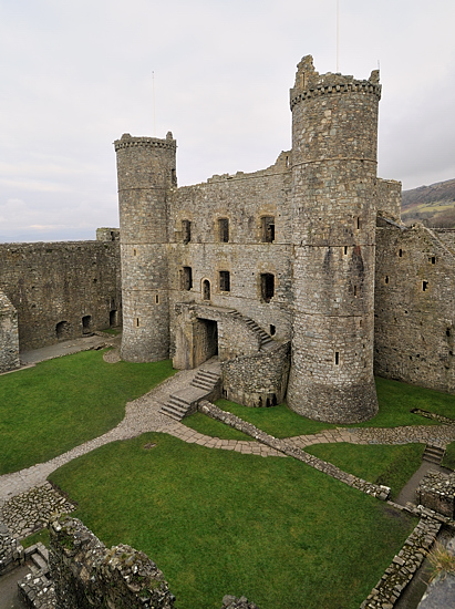
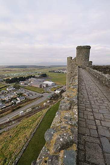
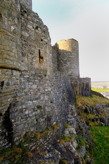
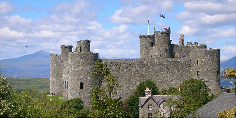
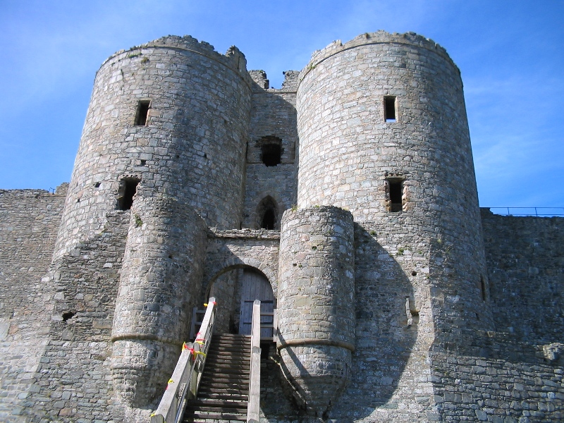
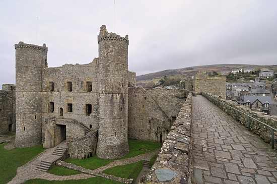
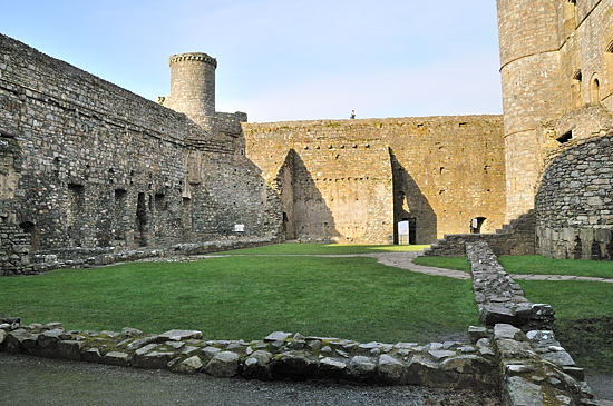
When visiting two things stand out, the way it is a solid part of a major rock and the gatehouse. The cliffs below are now sand dunes, but at the time the sea came up to the foot of the cliffs. Construction started in 1283 and took 7 years to build, the design is one of defence layer within layer. The outer ditches at Harlech were "hacked through solid rock". In the height of construction, in 1286, the workforce was "546 general labourers, 115 quarryers, 30 blacksmiths, 22 carpenters and 227 stonemasons. The outer walls are much shorter and thinner than the mighty inner walls, and have no towers defending them besides the gatehouse. The inner ward is roughly square, with a large round tower at each corner. The domestic buildings, including the great hall, are built against the inside of the inner walls. Since the surrounding cliffs made it practically impossible to attack the castle, except from the east, this side is faced by the imposing gatehouse. The gate is flanked by two massive "D-shaped" towers, the standard plan of the era, and defended by a series of doors, portcullises and murder-holes. There are large windows on the inner face of the gatehouse, showing its second role as the premier domestic accommodation. The west wall of the inner ward also has large windows (as it forms one wall of the great hall), which would make it vulnerable were it not for the cliffs. Although grey today, it was painted bright white when built. Edward's forces were often in danger from land-based attack, but he enjoyed total supremacy on water. Many of his castles included "sally ports" which allowed re-supply from the sea, but Harlech is far more elaborate. Here, a fortified stairway hugs the rock and runs almost 200 feet down to the foot of the cliffs, where at the time of construction the sea reached. Today, the sea has retreated several miles. James of St. George's plan was a triumph, when the castle was besieged during Madoc ap Llywelyn's campaign, this stairway was used to supply the castle.
Harlech Castle
It continued to be used and has an extended history. During the English Civil War the castle was the last Royalist fortress to hold out against the Parliamentary forces. The surrender, on 16 March 1647, over a year after King Charles had himself been captured, marked the end of the first phase of the war. The Parliamentarians slighted (damaged) the castle after its fall, like many others, so it could not be held against them again. It offers a wide range of photographic opportunities, from along the coast, from below and from inland. The castle structure itself both offers views within and of the surrounding area and seascape. As well as the ground plan you can climb to the top of the walls and walk around the curtain wall, plus you can walk around the outside of the main curtain wall at ground level. The entrance gate is very strong and the marks from each level of defence can still be seen.
Harlech Castle
.
Please let us know any other information that we can add to the Further information and Planning Grids or page and any errors that you discover. Before making a long trip to any location it is always wise to double check the current information, websites like magazines may be correct at the time the information is written, but things change and it is of course impossible to double check all entries on a regular basis. If you have any good photographs that you feel would improve the illustration of this page then please let us have copies. In referring to this page it is helpful if you quote both the Page Ref and Classification from the Grids above. To print the planning grid select it then right click and print the selected area. Please submit information on locations you discover so that this system continues to grow.
|
||||||||||||||||||||||||||||||||||||||||||||||||||||||||||||||||||||||||||||||
. |
||||||||||||||||||||||||||||||||||||||||||||||||||||||||||||||||||||||||||||||
|
||||||||||||||||||||||||||||||||||||||||||||||||||||||||||||||||||||||||||||||
|
|